Apiaká people make an agreement with neighbors for consensual use of part of the territory
In addition to contributing to sociobiodiversity, a close ties between communities and strengthens territorial monitoring
AI generated audio
The borders – literally and figuratively – are liquid at the meeting point between Mato Grosso, Amazonas and Pará. On the triple border, where the Juruena and Teles Pires rivers converge in the Tapajós, the flow of water is Amazonian, but not the only one. There is a cross-border flow of people. When they need straws to cover their homes, residents of the riverside community of Barra do São Manoel, on the Amazon edge, and from some villages of the Ti Munduruku, on the Pará side, access the Apiaká do Pontal and Isolados, at the Mato Grosso.
The reason for the crossing is that the babassu, a palm from which they remove the straw, is much more abundant in the Apiaká territory. In addition to the leaves of the palm, they also usually fish, hunt and collect tracajá eggs. And eventually the Apiaká also access these neighboring territories for the same purpose. This exchange has been going on for a long time and has now been formalized.
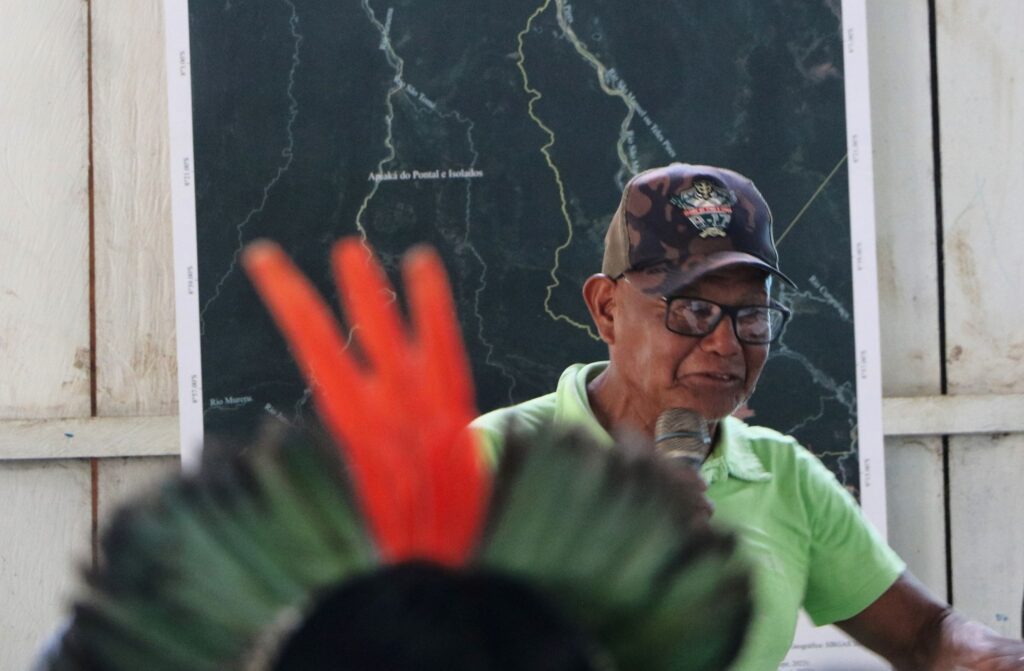
Prepared and signed by leaders of the three parties involved, the “Agreement of Fisheries and Traditional Use in Consensus in the Area of the Apiaká do Pontal and Isolados Indigenous Land” encompasses the northern region of the indigenous territory and areas adjacent to the mouth of the Juruena River and the mouth of the Teles Pires (or São Manoel), where the riverside community and the Munduruku villages are located.
In the region covered, fishing activities, fruit collection and extraction of forest resources will be allowed, but only by people from the communities involved and exclusively for local consumption, with external commercialization being prohibited. The objective is to conserve the necessary natural resources to guarantee food sovereignty, quality of life and traditionality in the region.

Photo: Túlio Paniago/OPAN
‘We came to a consensus to work in this way, one respecting the situation and the needs of the other. It was the best path we found together with our partners and neighbors. Apiaká of the Matrixã village.
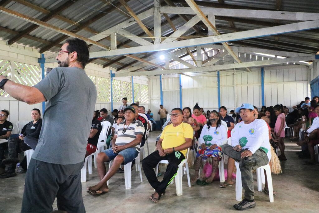
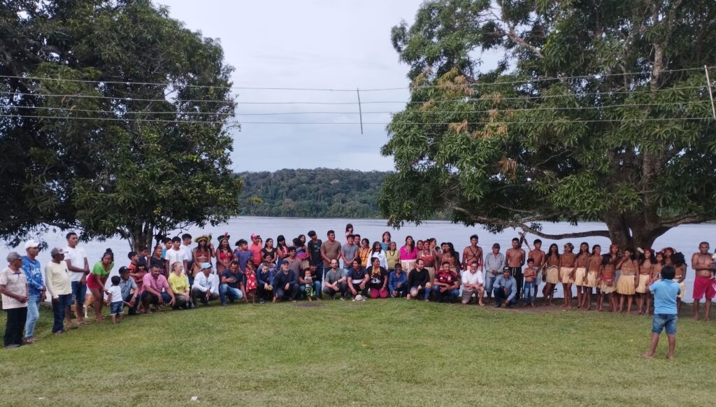
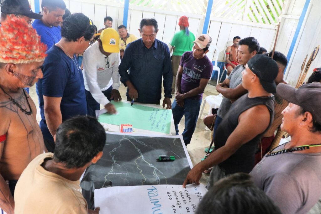
With the participation of leaders Apiaká, Munduruku and the community of Barra de São Manoel, the agreement was signed in March during a workshop for the preparation of the PGTA of the TI Apiaká do Pontal and Isolados, which did not happen in the riverside community, in the Triple region. Border between Amazonas, Mato Grosso and Pará, precisely where Juruena and Teles Pires converge in Tapajós.

As these rivers are the only routes of access to the Apiaká territory on its northern border, the agreement is also important from the point of view of territorial surveillance and monitoring. “Some villages of Munduruku relatives and, mainly, the Barra community are at the gateway to our territory. from the Pontal village.

Photo: Túlio Paniago/OPAN
By benefiting all those involved according to their needs, this initiative based on dialogue and collective construction has the potential to become a positive example for the construction of more robust management plans, which consider the area, the surroundings and the different actors involved in the same socio-environmental situation.
“The novelty is the aggregating spirit that the Apiaká are working with. In addition to covering a discussion among the residents of the indigenous land, they are also extending this debate to those who have border relations with them, so that a more regional context of protection and understanding is created for the best uses What can be done about resources”, evaluates Rinaldo Arruda, anthropologist and indigenist responsible for leading the facilitation workshops for the elaboration of the PGTA Apiaká.

Photo: Túlio Paniago/OPAN
The document, which had been sewn for years, consists of 21 articles specifying each agreement. ‘We’ve been doing this for a long time, but it was good to put it on paper. Now everyone knows exactly what they can take from the indigenous land. And it’s not something that will take away to harm or sell. Manuel.
In addition to the villages of the Apiaká people (Pontal, Kanindé, Matrixã, Mayrowi, Três Marias LLL) and the riverside community of Barra de São Manoel, the villages of the Ti Munduruku are also part of the agreement, close to the mouth of the Teles Pires, in the case of Patuazal, Santa Cruz, Primavera, Teles Pires, Restinga, Ariramba Teles Pires, Castanheira, Vista Alegre do Tapajós and Papagaio.
Shared Management with ICMBio
In September 2024, after more than three decades of mobilizations and articulations, TI Apiaká do Pontal and Isolados was officially declared by the Brazilian State, although it still awaits demarcation. They are proud to say that, during this long struggle for the resumption, no Apiaká lost his life.
This diplomatic character has guided the relations of the Apiaká with their interlocutors, whether they are partners, neighbors or government agencies. A good example is the shared management with the Chico Mendes Institute for Biodiversity Conservation (ICMBio), resulting from the overlap between the areas of the Apiaká do Pontal and Isolados (MT) IT and the Juruena National Park (Parnaju).
As the dimensions of the park are much larger, the overlapping part represents practically the total area of the indigenous land. Thus, the Apiaká and ICMBio, responsible for managing federal conservation units, manage the overlapping area.

Photo: Túlio Paniago/OPAN
‘It is the Apiaká’s style of work that enables this joint management. And now they are still incorporating the use in consensus of plots of the territory by riverside communities and other indigenous communities. This monitoring. They are joining efforts”, comments Rinaldo Arruda.
The elaboration of the PGTA of TI Apiaká do Pontal and Isolados has been characterized by this diplomatic and dialectical proposal, focusing on dialogue and collective construction. ICMBio has also participated and contributed to the discussions, after all, the PGTA Apiaká and the Parnaju Management Plan must be aligned.

Photo: Tulio Paniago
‘These are two planning and management instruments for the same superimposed area. They have many similarities. A PGTA cannot work if it is not in line with the conservation unit management plan. Likewise, when we go to review the management plan, it is important to participate in indigenous people. Update without consulting who will be directly affected?”, points out Juliana Carvalho Arantes, environmental analyst at ICMBio.
Pgta Apiaká and the next steps
With regard to the process of building the PGTA, the shared management of the territory and the term of use in consensus are themes related to the “territory and environment” and “social organization and governance” axes. In the next meetings, the agreements of the remaining three thematic axes will be defined: Economy; food health and safety; education and culture. The work will be completed in 2026.
The PGTAs reflect the management of the territory in social and environmental aspects. It is an instrument of political struggle that brings together the main guidelines of each people with regard to history, social and political organization, culture, education, health, income generation, surveillance, monitoring, food and other issues relevant to the people.
In addition to a series of internal agreements on various topics, the PGTAs bring together management instruments (ethnomapping and ethnozoning) of the territories and constitute an important political tool and community autonomy, after all they enable people to project their voices on issues of sovereignty and environmental conservation.
The elaboration of the PGTA of Ti Apiaká do Pontal e Isolados and the implementation of the PGTA of the Rikbaktsa people are structuring axes of the cradle of the waters, a project carried out by the Native Amazon Operation (OPAN) with the Apiaká peoples and Rikbaktsa, sponsored by the Petrobras Socio-environmental Program.